
Austin topographic map
Interactive map
Click on the map to display elevation.
About this map
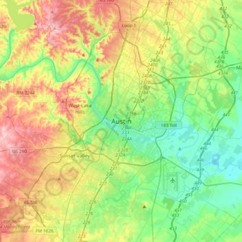
Name: Austin topographic map, elevation, terrain.
Location: Austin, Travis County, Texas, 78701, États-Unis d'Amérique (30.11113 -97.90370 30.43113 -97.58370)
Average elevation: 203 m
Minimum elevation: 118 m
Maximum elevation: 350 m