Geolocate

Groet topographic map

Click on the map to display elevation.

About this map

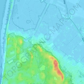
Name: Groet topographic map, elevation, terrain.

Location: Groet, Bergen, Noord-Holland, Nederland, 1873, Nederland (52.70187 4.64803 52.74187 4.68803)

Average elevation: 6 m

Minimum elevation: -4 m

Maximum elevation: 44 m

Gear up for your next adventure:

🧴Outdoor Sunscreen - High SPF protection for high-altitude UV exposure
🔦LED Headtorch - Bright and durable light for night activities
🎒Fully Waterproof Backpack - Total protection for photography gear and electronics
🛶Canoe Life Vest - Safety vest for water sports
🧢Sun Hat - Wide-brim hat for sun protection

As an Amazon Associate, this site earns from qualifying purchases at no extra cost to you.