Geolocate

Hartberg topographic map

Click on the map to display elevation.

About this map

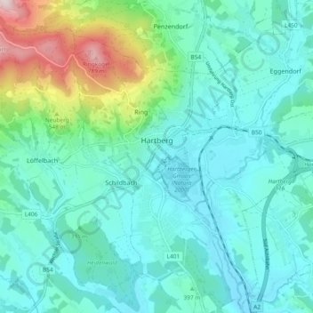
Name: Hartberg topographic map, elevation, terrain.

Location: Hartberg, Bezirk Hartberg-Fürstenfeld, Styria, 8230, Austria (47.24609 15.94411 47.30904 16.02669)

Average elevation: 409 m

Minimum elevation: 309 m

Maximum elevation: 823 m

Gear up for your next adventure:

🚲Handlebar Phone Mount - View topographic-map.com live while cycling
🎒Fully Waterproof Backpack - Total protection for photography gear and electronics
🧢Outdoor Cap - Protective cap for sun and rain during hikes
🥾Lightweight Hiking Shoes - Comfortable shoes for day hikes
🔦UV Flashlight - Detect minerals or specific insects in the dark

As an Amazon Associate, this site earns from qualifying purchases at no extra cost to you.