Geolocate

Arpea topographic map

Click on the map to display elevation.

About this map
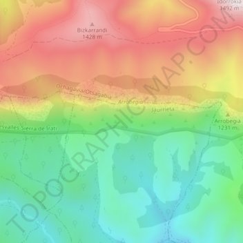
Name: Arpea topographic map, elevation, terrain.

Location: Arpea, Jaurrieta, Navarra, España (42.93696 -1.15874 42.95696 -1.13874)

Average elevation: 1,136 m

Minimum elevation: 869 m

Maximum elevation: 1,484 m

Gear up for your next adventure:

🦟Insect Repellent - Keep mosquitoes and black flies away in wooded areas
🧣Merino Neck Gaiter - Protects against wind, sun, and cold at high altitudes
🧴Outdoor Sunscreen - High SPF protection for high-altitude UV exposure
🗺️Topographic Maps - Detailed maps to explore trails, mountains, and wilderness areas
⛺Camping Tent - Weather-resistant tents suitable for 2 to 6 people

As an Amazon Associate, this site earns from qualifying purchases at no extra cost to you.