
Thank you for supporting this site ❤️
Make a donation
Make a donation
Gear up for your next adventure:
As an Amazon Associate, this site earns from qualifying purchases at no extra cost to you.
Guadalupe topographic map
Click on the map to display elevation.
Thank you for supporting this site ❤️
Make a donation
Make a donation
Gear up for your next adventure:
As an Amazon Associate, this site earns from qualifying purchases at no extra cost to you.
About this map
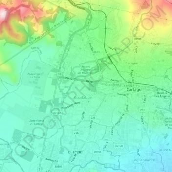
Name: Guadalupe topographic map, elevation, terrain.
Location: Guadalupe, Cartago, Cartago Province, 30106, Costa Rica (9.84669 -83.98474 9.88410 -83.92903)
Average elevation: 1,445 m
Minimum elevation: 1,317 m
Maximum elevation: 1,792 m
Thank you for supporting this site ❤️
Make a donation
Make a donation
Gear up for your next adventure:
As an Amazon Associate, this site earns from qualifying purchases at no extra cost to you.