Geolocate

Paji topographic map

Click on the map to display elevation.

About this map

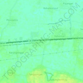
Name: Paji topographic map, elevation, terrain.

Location: Paji, Lamongan, East Java, Java, 62257, Indonesia (-7.11525 112.28500 -7.07525 112.32500)

Average elevation: 7 m

Minimum elevation: -1 m

Maximum elevation: 16 m

Other topographic maps

Click on a map to view its topography, its elevation and its terrain.

Sidokumpul

Indonesia > East Java > Lamongan > Sambeng

Average elevation: 74 m

Gondang Dam

Indonesia > East Java > Lamongan > Deketagung

Average elevation: 39 m

Lamongan

Indonesia > East Java > Lamongan

Average elevation: 30 m

Gear up for your next adventure:

🧭GPS Handheld Device - Reliable GPS navigation for outdoor adventures
💧Filtered Water Bottle - Safe drinking water on the go
🛰️Satellite Messenger - Emergency communication for areas with no cell service
Lightweight Camping Tent - Portable shelter optimized for Canadian backcountry camping
🧦Outdoor Socks - Durable socks designed for hiking and outdoor sports

As an Amazon Associate, this site earns from qualifying purchases at no extra cost to you.