
Ibagué topographic map
Interactive map
Click on the map to display elevation.
About this map
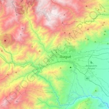
Name: Ibagué topographic map, elevation, terrain.
Location: Ibagué, Tolima, 730001, Colombia (4.28466 -75.40300 4.60466 -75.08300)
Average elevation: 1,868 m
Minimum elevation: 540 m
Maximum elevation: 3,755 m
Other topographic maps
Click on a map to view its topography, its elevation and its terrain.