Geolocate

Pine Valley topographic map

Click on the map to display elevation.

About this map

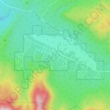
Name: Pine Valley topographic map, elevation, terrain.

Location: Pine Valley, Washington County, Utah, 84781, United States (37.37253 -113.53459 37.40749 -113.47849)

Average elevation: 2,093 m

Minimum elevation: 1,899 m

Maximum elevation: 2,528 m

Gear up for your next adventure:

🔦UV Flashlight - Detect minerals or specific insects in the dark
🥾Approach Shoes - Shoes designed for climbing approaches and rugged trails
🥾All-Terrain Hiking Boots - Versatile boots for varied hiking conditions
🔦LED Flashlight - Powerful and long-lasting flashlight for camping and emergencies
🥾Approach Boots - Comfortable boots for hiking and climbing approaches

As an Amazon Associate, this site earns from qualifying purchases at no extra cost to you.