
Thank you for supporting this site ❤️
Make a donation
Make a donation
Gear up for your next adventure:
As an Amazon Associate, this site earns from qualifying purchases at no extra cost to you.
Hanyatak topographic map
Click on the map to display elevation.
Thank you for supporting this site ❤️
Make a donation
Make a donation
Gear up for your next adventure:
As an Amazon Associate, this site earns from qualifying purchases at no extra cost to you.
About this map
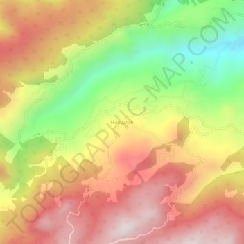
Name: Hanyatak topographic map, elevation, terrain.
Location: Hanyatak, Akyazı, Sakarya, Marmara Region, Turkey (40.53051 30.61880 40.57051 30.65880)
Average elevation: 872 m
Minimum elevation: 383 m
Maximum elevation: 1,277 m
Thank you for supporting this site ❤️
Make a donation
Make a donation
Gear up for your next adventure:
As an Amazon Associate, this site earns from qualifying purchases at no extra cost to you.