
Marlborough topographic map
Interactive map
Click on the map to display elevation.
About this map
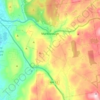
Name: Marlborough topographic map, elevation, terrain.
Average elevation: 299 m
Minimum elevation: 135 m
Maximum elevation: 509 m
According to the United States Census Bureau, the town has a total area of 20.6 square miles (53.4 km2), of which 20.4 sq mi (52.8 km2) is land and 0.2 sq mi (0.5 km2) is water, comprising 1.16% of the town. Marlborough is drained by Minnewawa Brook. The town's highest point is near its southeast corner, on the side of Bigelow Hill, where the elevation reaches 1,516 feet (462 m) above sea level.