
Make a donation
Gear up for your next adventure:
As an Amazon Associate, this site earns from qualifying purchases at no extra cost to you.
Yerpedu topographic map
Click on the map to display elevation.
Make a donation
Gear up for your next adventure:
As an Amazon Associate, this site earns from qualifying purchases at no extra cost to you.
Yerpedu
Yerpedu is located at 13°41′00″N 79°36′00″E / 13.6833°N 79.6°E / 13.6833; 79.6. It has an average elevation of 89 metres (292 ft). It is 25 kms away from Tirupati. The distance to Sri Kalahasti is about 20Km. Yerpedu Railway station is situated here.
Make a donation
Gear up for your next adventure:
As an Amazon Associate, this site earns from qualifying purchases at no extra cost to you.
About this map
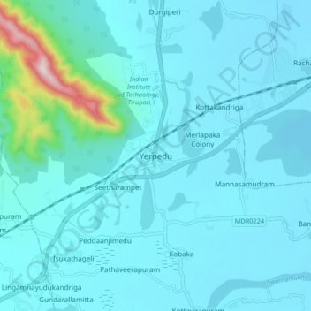
Name: Yerpedu topographic map, elevation, terrain.
Location: Yerpedu, Tirupati, Andhra Pradesh, 517619, India (13.65593 79.55445 13.73593 79.63445)
Average elevation: 128 m
Minimum elevation: 71 m
Maximum elevation: 660 m
Make a donation
Gear up for your next adventure:
As an Amazon Associate, this site earns from qualifying purchases at no extra cost to you.