Geolocate

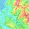
Sabón topographic map

Click on the map to display elevation.

About this map

Name: Sabón topographic map, elevation, terrain.

Location: Sabón, Oseiro, Arteixo, La Coruña, Galicia, 15142, España (43.30609 -8.52289 43.34609 -8.48289)

Average elevation: 42 m

Minimum elevation: -16 m

Maximum elevation: 203 m

Other topographic maps

Click on a map to view its topography, its elevation and its terrain.

Loureda

España > Galicia > La Coruña > Arteixo

Average elevation: 183 m

Oseiro

España > Galicia > La Coruña > Arteixo

Average elevation: 80 m

Pastoriza

España > Galicia > La Coruña > Arteixo

Average elevation: 104 m

Morás

España > Galicia > La Coruña > Arteixo

Average elevation: 135 m

Gear up for your next adventure:

⛺Lightweight Backpacking Tent - Compact tent for efficient hiking trips
💡Compact LED Flashlight - Powerful and portable flashlight for outdoor use
🧥Softshell Hiking Jacket - The perfect balance of wind protection and breathability
🏕️Camping Hammock - Integrated protection for sleeping between trees
🥾Light Hiking Boots - Lightweight and comfortable boots for day hikes

As an Amazon Associate, this site earns from qualifying purchases at no extra cost to you.