
Thank you for supporting this site ❤️
Make a donation
Make a donation
Gear up for your next adventure:
As an Amazon Associate, this site earns from qualifying purchases at no extra cost to you.
Poços topographic map
Click on the map to display elevation.
Thank you for supporting this site ❤️
Make a donation
Make a donation
Gear up for your next adventure:
As an Amazon Associate, this site earns from qualifying purchases at no extra cost to you.
About this map
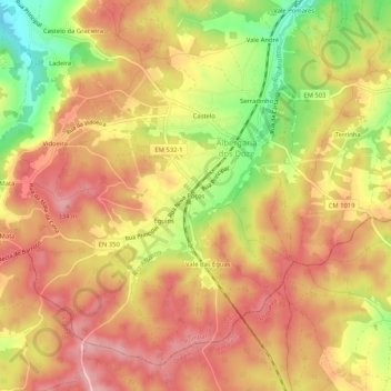
Name: Poços topographic map, elevation, terrain.
Location: Poços, Albergaria dos Doze, Pombal, Leiria, 3100-081, Portugal (39.77425 -8.60823 39.81425 -8.56823)
Average elevation: 269 m
Minimum elevation: 175 m
Maximum elevation: 326 m
Thank you for supporting this site ❤️
Make a donation
Make a donation
Gear up for your next adventure:
As an Amazon Associate, this site earns from qualifying purchases at no extra cost to you.