
Thank you for supporting this site ❤️
Make a donation
Make a donation
Gear up for your next adventure:
As an Amazon Associate, this site earns from qualifying purchases at no extra cost to you.
Vrådal topographic map
Click on the map to display elevation.
Thank you for supporting this site ❤️
Make a donation
Make a donation
Gear up for your next adventure:
As an Amazon Associate, this site earns from qualifying purchases at no extra cost to you.
About this map
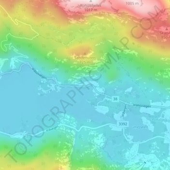
Name: Vrådal topographic map, elevation, terrain.
Location: Vrådal, Kviteseid, Vestfold og Telemark, 3853, Norway (59.30783 8.39570 59.34783 8.43570)
Average elevation: 433 m
Minimum elevation: 240 m
Maximum elevation: 997 m
Thank you for supporting this site ❤️
Make a donation
Make a donation
Gear up for your next adventure:
As an Amazon Associate, this site earns from qualifying purchases at no extra cost to you.