Geolocate

Ila topographic map

Click on the map to display elevation.

About this map

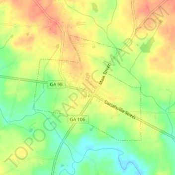
Name: Ila topographic map, elevation, terrain.

Location: Ila, Madison County, Georgia, United States (34.16534 -83.30363 34.18166 -83.28351)

Average elevation: 241 m

Minimum elevation: 213 m

Maximum elevation: 264 m

Other topographic maps

Click on a map to view its topography, its elevation and its terrain.

Dogsboro

United States > Georgia > Madison County

Average elevation: 246 m

Gear up for your next adventure:

👟Leg Gaiters - Keep debris, mud, and snow out of your boots
🔦LED Headtorch - Bright and durable light for night activities
🔥Camping Stove - Portable stoves to cook outdoors with ease
🛌Down Sleeping Bag - Superior warmth-to-weight ratio for cold nights
💧Hydration Pack - Hands-free hydration system for long hikes

As an Amazon Associate, this site earns from qualifying purchases at no extra cost to you.