Geolocate

Hampi topographic map

Click on the map to display elevation.

About this map

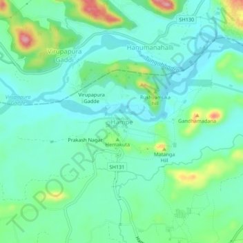
Name: Hampi topographic map, elevation, terrain.

Location: Hampi, Hosapete taluk, Vijayanagara, Karnataka, 583239, India (15.31580 76.44102 15.35580 76.48102)

Average elevation: 436 m

Minimum elevation: 403 m

Maximum elevation: 534 m

Other topographic maps

Click on a map to view its topography, its elevation and its terrain.

Tungabhadra Dam

India > Karnataka > Hosapete taluk > Hosapete

Average elevation: 491 m

Gear up for your next adventure:

🏃Hydration Running Vest - Carry water and maps close to your body for speed
🎒Hiking Daypack - Lightweight and durable backpacks for day trips and excursions
🥾Waterproof Hiking Boots - Boots keeping your feet dry in wet conditions
🪑Insulated Seat Pad - Protect your seat from cold rocks and wet logs
🥫Freeze-Dried Meals - Lightweight, high-calorie nutrition for multi-day treks

As an Amazon Associate, this site earns from qualifying purchases at no extra cost to you.