Geolocate

Immingham topographic map

Click on the map to display elevation.

About this map

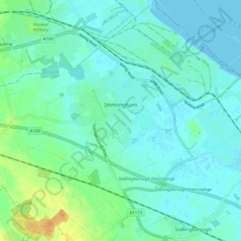
Name: Immingham topographic map, elevation, terrain.

Location: Immingham, North East Lincolnshire, England, United Kingdom (53.58445 -0.25208 53.64012 -0.15845)

Average elevation: 7 m

Minimum elevation: -2 m

Maximum elevation: 31 m

Gear up for your next adventure:

🌬️Windproof Camp Stove - Efficient cooking even on exposed mountain peaks
🛌Down Sleeping Bag - Superior warmth-to-weight ratio for cold nights
🩹Compact First Aid Kit - Pre-packed essentials for common trail injuries
🧴Insect Repellent - Protect yourself from bugs during outdoor adventures
🎒Backpack Rain Cover - External shield to keep your entire pack dry

As an Amazon Associate, this site earns from qualifying purchases at no extra cost to you.