
Thank you for supporting this site ❤️
Make a donation
Make a donation
Gear up for your next adventure:
As an Amazon Associate, this site earns from qualifying purchases at no extra cost to you.
Ashapuri topographic map
Click on the map to display elevation.
Thank you for supporting this site ❤️
Make a donation
Make a donation
Gear up for your next adventure:
As an Amazon Associate, this site earns from qualifying purchases at no extra cost to you.
About this map
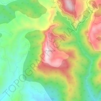
Name: Ashapuri topographic map, elevation, terrain.
Location: Ashapuri, Jaisinghpur, Kangra, Himachal Pradesh, India (31.95543 76.55874 31.99543 76.59874)
Average elevation: 984 m
Minimum elevation: 696 m
Maximum elevation: 1,371 m
Thank you for supporting this site ❤️
Make a donation
Make a donation
Gear up for your next adventure:
As an Amazon Associate, this site earns from qualifying purchases at no extra cost to you.