Geolocate

Gangaur topographic map

Click on the map to display elevation.

About this map

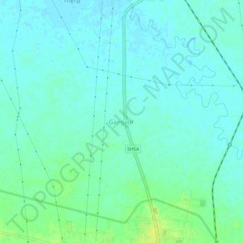
Name: Gangaur topographic map, elevation, terrain.

Location: Gangaur, Robertsganj, Sonbhadra, Uttar Pradesh, 231216, India (24.69819 83.03935 24.73819 83.07935)

Average elevation: 305 m

Minimum elevation: 300 m

Maximum elevation: 317 m

Gear up for your next adventure:

🔨Vehicle Emergency Tool - Safety tool for remote road trips to trailheads
🌬️Windproof Camp Stove - Efficient cooking even on exposed mountain peaks
💡LED Camping Lantern - Illuminate your campsite with long-lasting lanterns
🥾Trekking Poles - Adjustable trekking poles to reduce knee stress and improve stability
🔦LED Headtorch - Bright and durable light for night activities

As an Amazon Associate, this site earns from qualifying purchases at no extra cost to you.