
Västerås topographic map
Interactive map
Click on the map to display elevation.
About this map
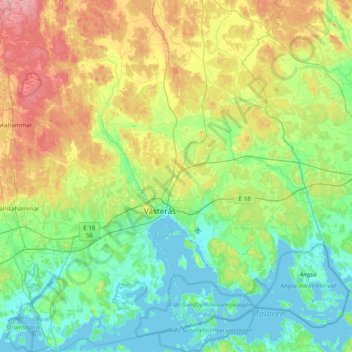
Name: Västerås topographic map, elevation, terrain.
Location: Västerås, Provincia de Västmanland, Svealand, Suecia (59.45233 16.23463 59.84598 16.96595)
Average elevation: 33 m
Minimum elevation: -4 m
Maximum elevation: 116 m
Other topographic maps
Click on a map to view its topography, its elevation and its terrain.
Köping
Suecia > Provincia de Västmanland
Köping, Provincia de Västmanland, Svealand, Suecia
Average elevation: 56 m