Geolocate

Lowestoft topographic map

Click on the map to display elevation.

About this map

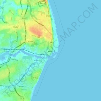
Name: Lowestoft topographic map, elevation, terrain.

Location: Lowestoft, East Suffolk, Suffolk, East of England, England, United Kingdom (52.44474 1.69212 52.50948 1.76891)

Average elevation: 6 m

Minimum elevation: -3 m

Maximum elevation: 34 m

Gear up for your next adventure:

🥾Approach Boots - Comfortable boots for hiking and climbing approaches
🥾Lightweight Hiking Boots - Boots for comfort and mobility on long hikes
🦯Trekking Poles - Reduced impact on joints for steep topographic climbs
🥫Freeze-Dried Meals - Lightweight, high-calorie nutrition for multi-day treks
Camping Groundsheet - Protect your tent from moisture and dirt

As an Amazon Associate, this site earns from qualifying purchases at no extra cost to you.