Geolocate

Pukekawa topographic map

Click on the map to display elevation.

About this map

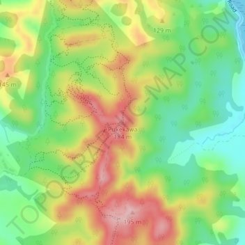
Name: Pukekawa topographic map, elevation, terrain.

Location: Pukekawa, Franklin, Auckland, 2018, New Zealand (-36.90778 175.04686 -36.90768 175.04696)

Average elevation: 84 m

Minimum elevation: 0 m

Maximum elevation: 185 m

Gear up for your next adventure:

🧳Compression Sacks - Maximize space in your backpack by shrinking gear
🧢Beanie Hat - Keep your head warm in cold weather
Camping Essentials - All-in-one gear for a comfortable camping trip
🥾Mountaineering Boots - Supportive boots for climbing and high-altitude hiking
🥾Mountain Hiking Boots - High-traction boots for rocky terrain

As an Amazon Associate, this site earns from qualifying purchases at no extra cost to you.