
Hohentauern topographic map
Interactive map
Click on the map to display elevation.
About this map
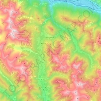
Name: Hohentauern topographic map, elevation, terrain.
Location: Hohentauern, Bezirk Murtal, Styria, 8785, Austria (47.36157 14.39597 47.46770 14.61474)
Average elevation: 1,525 m
Minimum elevation: 696 m
Maximum elevation: 2,415 m