Geolocate

Deans topographic map

Click on the map to display elevation.

About this map

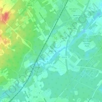
Name: Deans topographic map, elevation, terrain.

Location: Deans, South Brunswick, Middlesex County, New Jersey, 08810, United States (40.38427 -74.53599 40.42427 -74.49599)

Average elevation: 34 m

Minimum elevation: 17 m

Maximum elevation: 75 m

Other topographic maps

Click on a map to view its topography, its elevation and its terrain.

Gear up for your next adventure:

🧢Outdoor Cap - Protective cap for sun and rain during hikes
🥘Camping Cookware Set - Compact nesting pots and pans for trail cooking
🛰️Satellite Messenger - Emergency communication for areas with no cell service
Backpacking Tent - Lightweight tent for long-distance hiking trips
🧦Outdoor Socks - Durable socks designed for hiking and outdoor sports

As an Amazon Associate, this site earns from qualifying purchases at no extra cost to you.