
Make a donation
Gear up for your next adventure:
As an Amazon Associate, this site earns from qualifying purchases at no extra cost to you.
Mud Pond topographic map
Click on the map to display elevation.
Make a donation
Gear up for your next adventure:
As an Amazon Associate, this site earns from qualifying purchases at no extra cost to you.
About this map
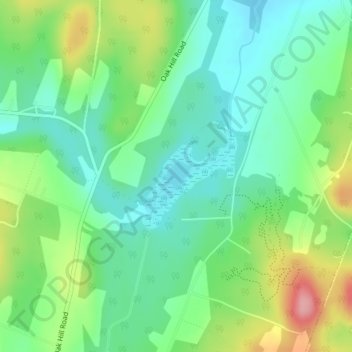
Name: Mud Pond topographic map, elevation, terrain.
Average elevation: 227 m
Minimum elevation: 186 m
Maximum elevation: 310 m
Make a donation
Gear up for your next adventure:
As an Amazon Associate, this site earns from qualifying purchases at no extra cost to you.
Other topographic maps
Click on a map to view its topography, its elevation and its terrain.
Lake Iroquois
United States > Vermont > Chittenden County > Williston
Lake Surface Area: 247 acres Drainage Basin Area: 2, 418 acres Maximum Depth: 37 ft. Average Depth: 19 ft. Elevation: 685 ft.
Average elevation: 257 m
Lake Iroquois
United States > Vermont > Chittenden County > Williston
Lake Surface Area: 247 acres Drainage Basin Area: 2, 418 acres Maximum Depth: 37 ft. Average Depth: 19 ft. Elevation: 685 ft.
Average elevation: 257 m