
Lamm topographic map
Interactive map
Click on the map to display elevation.
About this map
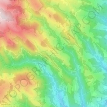
Name: Lamm topographic map, elevation, terrain.
Location: Lamm, Sankt Andrä, Bezirk Wolfsberg, Kärnten, 9104, Österreich (46.74667 14.74667 46.78667 14.78667)
Average elevation: 760 m
Minimum elevation: 511 m
Maximum elevation: 1,101 m