
Bottrop topographic map
Click on the map to display elevation.
About this map
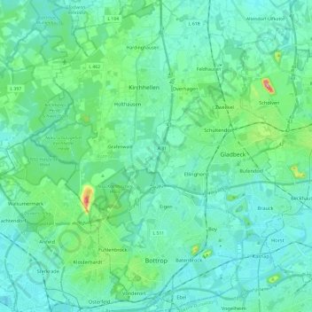
Name: Bottrop topographic map, elevation, terrain.
Location: Bottrop, North Rhine-Westphalia, Germany (51.49703 6.83290 51.64484 6.99911)
Average elevation: 53 m
Minimum elevation: 25 m
Maximum elevation: 198 m
Other topographic maps
Click on a map to view its topography, its elevation and its terrain.
Leichlingen
Germany > North Rhine-Westphalia > Rheinisch-Bergischer Kreis > Leichlingen > Leichlingen
Average elevation: 95 m