Geolocate

Pussey topographic map

Click on the map to display elevation.

About this map

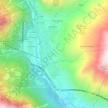
Name: Pussey topographic map, elevation, terrain.

Location: Pussey, Courmayeur, Aosta Valley, 11013, Italy (45.76716 6.95701 45.80716 6.99701)

Average elevation: 1,561 m

Minimum elevation: 1,022 m

Maximum elevation: 2,521 m

Gear up for your next adventure:

🩹Compact First Aid Kit - Pre-packed essentials for common trail injuries
💧Filtered Water Bottle - Safe drinking water on the go
🧴Outdoor Sunscreen - High SPF protection for high-altitude UV exposure
🧦Hiking Liner Socks - Thin base layer to prevent friction and blisters
🔦LED Flashlight - Powerful and long-lasting flashlight for camping and emergencies

As an Amazon Associate, this site earns from qualifying purchases at no extra cost to you.