Geolocate

Steep topographic map

Click on the map to display elevation.

About this map

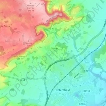
Name: Steep topographic map, elevation, terrain.

Location: Steep, East Hampshire, Hampshire, England, United Kingdom (51.00079 -0.97695 51.04070 -0.89336)

Average elevation: 115 m

Minimum elevation: 45 m

Maximum elevation: 253 m

Gear up for your next adventure:

🧭GPS Tracker - Track your location in remote areas safely
🚑Survival Whistle - Signal for help across long distances in mountains
💡LED Headlamp - Hands-free illumination for night hiking and camping
🛶Kayak Dry Bag - Waterproof storage for kayaking adventures
🧤Rechargeable Heated Gloves - Extreme warmth for Canadian winter expeditions

As an Amazon Associate, this site earns from qualifying purchases at no extra cost to you.