
Río Guadalquivir topographic map
Interactive map
Click on the map to display elevation.
About this map
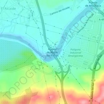
Name: Río Guadalquivir topographic map, elevation, terrain.
Location: Río Guadalquivir, Córdoba, Andalucía, 14013, España (37.84666 -4.80684 37.84961 -4.80286)
Average elevation: 115 m
Minimum elevation: 82 m
Maximum elevation: 200 m
Other topographic maps
Click on a map to view its topography, its elevation and its terrain.
Córdoba
El término municipal de Córdoba ocupa 1245 km², aproximadamente el 9 % del total de la provincia. Siendo el núcleo principal de población la zona más poblada, existen seis pedanías: El Higuerón, Alcolea, Santa Cruz, Cerro Muriano, Villarrubia y Santa María de Trassierra y una Entidad Local Menor,…
Average elevation: 262 m