Geolocate

Poylu topographic map

Click on the map to display elevation.

About this map

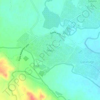
Name: Poylu topographic map, elevation, terrain.

Location: Poylu, Samukh District, Ganja-Dashkasan, Azerbaijan (41.13478 46.25768 41.14400 46.27852)

Average elevation: 132 m

Minimum elevation: 118 m

Maximum elevation: 172 m

Gear up for your next adventure:

🏃Hydration Running Vest - Carry water and maps close to your body for speed
👟Leg Gaiters - Keep debris, mud, and snow out of your boots
🦟Insect Repellent - Keep mosquitoes and black flies away in wooded areas
🥾Waterproof Hiking Boots - Boots keeping your feet dry in wet conditions
🦯Trekking Poles - Reduced impact on joints for steep topographic climbs

As an Amazon Associate, this site earns from qualifying purchases at no extra cost to you.