
Thank you for supporting this site ❤️
Make a donation
Make a donation
Gear up for your next adventure:
As an Amazon Associate, this site earns from qualifying purchases at no extra cost to you.
Siyahgird topographic map
Click on the map to display elevation.
Thank you for supporting this site ❤️
Make a donation
Make a donation
Gear up for your next adventure:
As an Amazon Associate, this site earns from qualifying purchases at no extra cost to you.
About this map
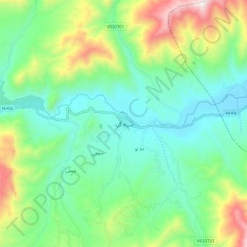
Name: Siyahgird topographic map, elevation, terrain.
Location: Siyahgird, Ghorband, Parwan Province, Afghanistan (34.95576 68.81618 35.03576 68.89618)
Average elevation: 2,102 m
Minimum elevation: 1,810 m
Maximum elevation: 2,811 m
Thank you for supporting this site ❤️
Make a donation
Make a donation
Gear up for your next adventure:
As an Amazon Associate, this site earns from qualifying purchases at no extra cost to you.