
Thank you for supporting this site ❤️
Make a donation
Make a donation
Gear up for your next adventure:
As an Amazon Associate, this site earns from qualifying purchases at no extra cost to you.
Gimbal topographic map
Click on the map to display elevation.
Thank you for supporting this site ❤️
Make a donation
Make a donation
Gear up for your next adventure:
As an Amazon Associate, this site earns from qualifying purchases at no extra cost to you.
About this map
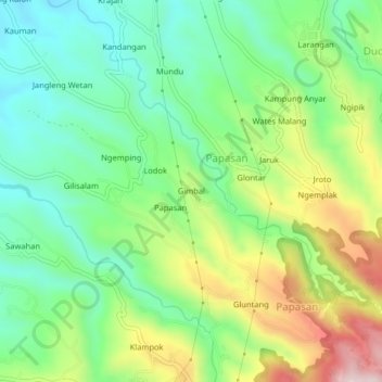
Name: Gimbal topographic map, elevation, terrain.
Location: Gimbal, Papasan, Jepara, Central Java, Java, Indonesia (-6.58286 110.79629 -6.54286 110.83629)
Average elevation: 313 m
Minimum elevation: 165 m
Maximum elevation: 579 m
Thank you for supporting this site ❤️
Make a donation
Make a donation
Gear up for your next adventure:
As an Amazon Associate, this site earns from qualifying purchases at no extra cost to you.