Geolocate

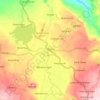
Matungao topographic map

Click on the map to display elevation.

About this map

Name: Matungao topographic map, elevation, terrain.

Location: Matungao, Lanao del Norte, Northern Mindanao, 9217, Philippines (8.09322 124.12713 8.17322 124.20713)

Average elevation: 310 m

Minimum elevation: 12 m

Maximum elevation: 530 m

Other topographic maps

Click on a map to view its topography, its elevation and its terrain.
Agus River

Philippines > Lanao del Norte

Average elevation: 499 m

Linamon

Philippines > Lanao del Norte

Average elevation: 44 m

Kolambugan

Philippines > Lanao del Norte

Average elevation: 55 m

Baloi

Philippines > Lanao del Norte > Baloi

Average elevation: 393 m

Agus River

Philippines > Lanao del Norte > West Pantar

Average elevation: 536 m

Linamon

Philippines > Lanao del Norte

Average elevation: 44 m

Gear up for your next adventure:

🍽️Titanium Camping Spork - Ultralight and indestructible eating utensil
💧Reusable Water Bottle - Durable water bottles for hydration on trails
🪜Heavy Duty Carabiners - Multi-use clips for securing gear to your backpack
🥾Trail Hiking Shoes - Durable shoes designed for rugged trails
🎒Backpack Rain Cover - External shield to keep your entire pack dry

As an Amazon Associate, this site earns from qualifying purchases at no extra cost to you.