Geolocate

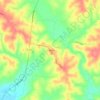
Oxford Junction topographic map

Click on the map to display elevation.

About this map

Name: Oxford Junction topographic map, elevation, terrain.

Location: Oxford Junction, Oxford Township, Jones County, Iowa, 52323, United States (41.97824 -90.96087 41.99013 -90.94669)

Average elevation: 225 m

Minimum elevation: 214 m

Maximum elevation: 256 m

Other topographic maps

Click on a map to view its topography, its elevation and its terrain.
Temple Hill

United States > Iowa > Jones County

Average elevation: 262 m

Gear up for your next adventure:

🧰Emergency Multi-Tool - Compact multi-tool for outdoor survival
🧥Softshell Hiking Jacket - The perfect balance of wind protection and breathability
🪜Heavy Duty Carabiners - Multi-use clips for securing gear to your backpack
🚲MTB Frame Bag - Carry tools and maps directly on your bicycle frame
💡Portable Camping Lamp - Rechargeable lamp for campsite lighting

As an Amazon Associate, this site earns from qualifying purchases at no extra cost to you.