Geolocate

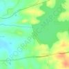
Nattukal topographic map

Click on the map to display elevation.

About this map

Name: Nattukal topographic map, elevation, terrain.

Location: Nattukal, Chittur, Palakkad, Kerala, 678554, India (10.71829 76.79688 10.75829 76.83688)

Average elevation: 143 m

Minimum elevation: 118 m

Maximum elevation: 166 m

Other topographic maps

Click on a map to view its topography, its elevation and its terrain.
Parambikulam

India > Kerala > Chittur

Average elevation: 696 m

Meenkara Dam

India > Kerala > Chittur > Govindapuram

Average elevation: 155 m

Chittur-Thathamangalam

India > Kerala > Chittur > Manchira

Average elevation: 117 m

Kaikatty

India > Kerala > Chittur

Average elevation: 929 m

Gear up for your next adventure:

🔋Emergency Crank Radio - Weather alerts and power without needing batteries
💡Portable Camping Lamp - Rechargeable lamp for campsite lighting
🪑Ultralight Camping Stool - Compact seating for rest stops during long hikes
🧰Multitool Knife - Compact and versatile tool for outdoor use
👟Leg Gaiters - Keep debris, mud, and snow out of your boots

As an Amazon Associate, this site earns from qualifying purchases at no extra cost to you.