Geolocate

Dharur topographic map

Click on the map to display elevation.

About this map

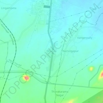
Name: Dharur topographic map, elevation, terrain.

Location: Dharur, Jagtial mandal, Jagtial, Telangana, 505455, India (18.74391 78.89367 18.78391 78.93367)

Average elevation: 295 m

Minimum elevation: 277 m

Maximum elevation: 375 m

Gear up for your next adventure:

👟Sport Hiking Sandals - Breathable footwear for water crossings and camp rest
🦶Hiking Shoe Insoles - Added support for high arches and long days on feet
Backpacking Tent - Lightweight tent for long-distance hiking trips
🛶Kayak Accessories - Essential gear for safe and fun kayaking adventures
🔪Outdoor Multitool - Versatile tool for repairs and food prep in the wild

As an Amazon Associate, this site earns from qualifying purchases at no extra cost to you.