Geolocate

Sispara topographic map

Click on the map to display elevation.

About this map
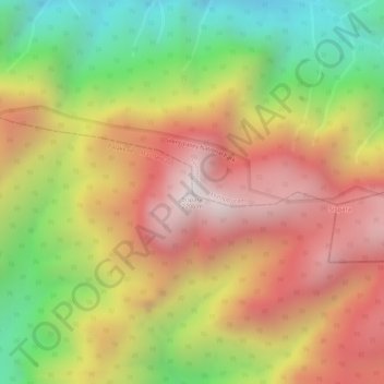
Name: Sispara topographic map, elevation, terrain.

Location: Sispara, Nilambur, Malappuram, Kerala, India (11.20384 76.42990 11.20394 76.43000)

Average elevation: 1,710 m

Minimum elevation: 1,137 m

Maximum elevation: 2,143 m

Other topographic maps

Click on a map to view its topography, its elevation and its terrain.

Munderi

India > Kerala > Nilambur

Average elevation: 459 m

Muthukadu

India > Kerala > Nilambur > Nilambur

Average elevation: 36 m

Nilamboor

India > Kerala > Nilambur

Average elevation: 551 m

Gear up for your next adventure:

🚑Survival Whistle - Signal for help across long distances in mountains
🛶Waterproof Dry Bags - Keep electronics and clothes dry during river crossings
🧤Thermal Hiking Gloves - Grip-enhanced gloves for cold-weather altitude trekking
💡Solar Camping Lamp - Eco-friendly lighting for campsites
🧣Merino Neck Gaiter - Protects against wind, sun, and cold at high altitudes

As an Amazon Associate, this site earns from qualifying purchases at no extra cost to you.