Geolocate

Nevegal topographic map

Click on the map to display elevation.

About this map

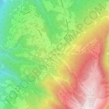
Name: Nevegal topographic map, elevation, terrain.

Location: Nevegal, Belluno, Veneto, Italy (46.07269 12.26104 46.11269 12.30104)

Average elevation: 1,076 m

Minimum elevation: 561 m

Maximum elevation: 1,641 m

Gear up for your next adventure:

🧢Outdoor Cap - Protective cap for sun and rain during hikes
🎒Fully Waterproof Backpack - Total protection for photography gear and electronics
🔋Lithium AA Batteries - Long-lasting power that performs in extreme cold
👟Trail Running Shoes - Agile footwear for fast-paced topographic exploration
🧦Hiking Liner Socks - Thin base layer to prevent friction and blisters

As an Amazon Associate, this site earns from qualifying purchases at no extra cost to you.