Geolocate

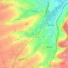
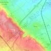
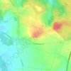
Carvin topographic map

Click on the map to display elevation.

About this map

Name: Carvin topographic map, elevation, terrain.

Location: Carvin, Lens, Pas-de-Calais, Hauts-de-France, Metropolitan France, 62220, France (50.46795 2.90913 50.51264 2.99459)

Average elevation: 29 m

Minimum elevation: 18 m

Maximum elevation: 101 m

Other topographic maps

Click on a map to view its topography, its elevation and its terrain.

Panehem

France > Hauts-de-France > Pas-de-Calais > Samer

Average elevation: 70 m

Noyelles

France > Hauts-de-France > Pas-de-Calais > Bours

Average elevation: 125 m

Le Petit Vimy

France > Hauts-de-France > Pas-de-Calais > Vimy

Average elevation: 93 m

Gear up for your next adventure:

🥽Outdoor Goggles - Protective eyewear for outdoor activities
🥾Durable Hiking Shoes - Long-lasting shoes for frequent hiking
🚲Bike Repair Kit - Essential tools for on-trail mechanical issues
🧢Sun Hat - Wide-brim hat for sun protection
⛺Camping Tent - Weather-resistant tents suitable for 2 to 6 people

As an Amazon Associate, this site earns from qualifying purchases at no extra cost to you.