Geolocate

Dervio topographic map

Click on the map to display elevation.

About this map

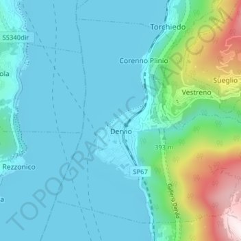
Name: Dervio topographic map, elevation, terrain.

Location: Dervio, Lecco, Lombardy, Italy (46.05961 9.28695 46.09734 9.35113)

Average elevation: 377 m

Minimum elevation: 193 m

Maximum elevation: 1,265 m

Other topographic maps

Click on a map to view its topography, its elevation and its terrain.

Olcio

Italy > Lombardy > Lecco > Mandello del Lario

Average elevation: 413 m

Grigna Settentrionale

Italy > Lombardy > Lecco > Pasturo

Average elevation: 1,875 m

Gear up for your next adventure:

🩹Moleskin Blister Pads - Direct protection for painful foot pressure points
🚲Bike Repair Kit - Essential tools for on-trail mechanical issues
🔦UV Flashlight - Detect minerals or specific insects in the dark
🐕Hiking Dog Pack - Let your canine companion carry their own water and food
Tent Footprint - Protect tent floor and increase durability

As an Amazon Associate, this site earns from qualifying purchases at no extra cost to you.