
Thank you for supporting this site ❤️
Make a donation
Make a donation
Gear up for your next adventure:
As an Amazon Associate, this site earns from qualifying purchases at no extra cost to you.
Tejamulya topographic map
Click on the map to display elevation.
Thank you for supporting this site ❤️
Make a donation
Make a donation
Gear up for your next adventure:
As an Amazon Associate, this site earns from qualifying purchases at no extra cost to you.
About this map
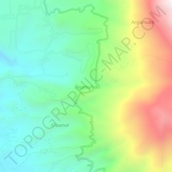
Name: Tejamulya topographic map, elevation, terrain.
Location: Tejamulya, Majalengka Regency, West Java, Indonesia (-6.93916 108.34793 -6.89916 108.38793)
Average elevation: 1,439 m
Minimum elevation: 1,001 m
Maximum elevation: 2,272 m
Thank you for supporting this site ❤️
Make a donation
Make a donation
Gear up for your next adventure:
As an Amazon Associate, this site earns from qualifying purchases at no extra cost to you.