Geolocate

Oakpark topographic map

Click on the map to display elevation.

About this map
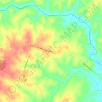
Name: Oakpark topographic map, elevation, terrain.

Location: Oakpark, Madison County, Virginia, 22730, United States (38.34680 -78.18000 38.38680 -78.14000)

Average elevation: 134 m

Minimum elevation: 99 m

Maximum elevation: 169 m

Other topographic maps

Click on a map to view its topography, its elevation and its terrain.
Rapidan River

United States > Virginia > Madison County

Average elevation: 125 m

Gear up for your next adventure:

🛶Kayak Dry Bag - Waterproof storage for kayaking adventures
👟Leg Gaiters - Keep debris, mud, and snow out of your boots
🧴Bear Spray Holster - Quick-access carry for essential Canadian wilderness safety
💧Hydration Pack - Hands-free hydration system for long hikes
🕯️Camping Lantern - Illuminates your entire campsite with high-efficiency LEDs

As an Amazon Associate, this site earns from qualifying purchases at no extra cost to you.