
Thank you for supporting this site ❤️
Make a donation
Make a donation
Gear up for your next adventure:
As an Amazon Associate, this site earns from qualifying purchases at no extra cost to you.
Chichubamba topographic map
Click on the map to display elevation.
Thank you for supporting this site ❤️
Make a donation
Make a donation
Gear up for your next adventure:
As an Amazon Associate, this site earns from qualifying purchases at no extra cost to you.
About this map
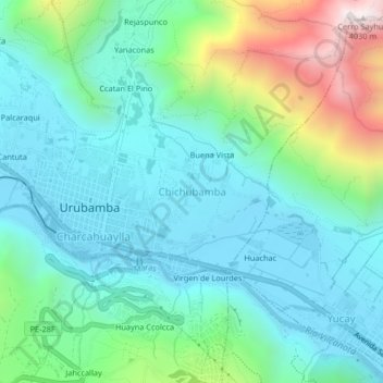
Name: Chichubamba topographic map, elevation, terrain.
Location: Chichubamba, Urubamba, Cusco, 08661, Perú (-13.32431 -72.12496 -13.28431 -72.08496)
Average elevation: 3,124 m
Minimum elevation: 2,848 m
Maximum elevation: 4,018 m
Thank you for supporting this site ❤️
Make a donation
Make a donation
Gear up for your next adventure:
As an Amazon Associate, this site earns from qualifying purchases at no extra cost to you.