Geolocate

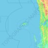
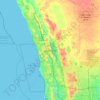
Caiguna topographic map

Click on the map to display elevation.

About this map

Name: Caiguna topographic map, elevation, terrain.

Location: Caiguna, Shire Of Dundas, Western Australia, Australia (-32.76117 124.44052 -31.37937 126.08474)

Average elevation: 103 m

Minimum elevation: 0 m

Maximum elevation: 177 m

Other topographic maps

Click on a map to view its topography, its elevation and its terrain.
Kings Park

Australia > Western Australia > Perth

Average elevation: 31 m

Augusta

Australia > Western Australia > Augusta

Average elevation: 31 m

Watervalley Park

Australia > Western Australia

Average elevation: 29 m

Moorehead

Australia > Western Australia

Average elevation: 197 m

Honeymoon Bay

Australia > Western Australia

Average elevation: 7 m

Swan River

Australia > Western Australia

Average elevation: 113 m

Cooke Creek

Australia > Western Australia > Onslow

Average elevation: 2 m

Joondalup

Australia > Western Australia

Average elevation: 33 m

Gear up for your next adventure:

🔨Vehicle Emergency Tool - Safety tool for remote road trips to trailheads
🔪Outdoor Multitool - Versatile tool for repairs and food prep in the wild
👟Leg Gaiters - Keep debris, mud, and snow out of your boots
🧢Outdoor Visor - Breathable visor for sunny hikes
💡Portable Camping Lamp - Rechargeable lamp for campsite lighting

As an Amazon Associate, this site earns from qualifying purchases at no extra cost to you.