
La Bouverie topographic map
Interactive map
Click on the map to display elevation.
About this map
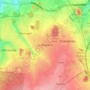
Name: La Bouverie topographic map, elevation, terrain.
Location: La Bouverie, Frameries, Mons, Hainaut, Wallonie, 7080, Belgique (50.38795 3.85756 50.42795 3.89756)
Average elevation: 96 m
Minimum elevation: 31 m
Maximum elevation: 138 m
Other topographic maps
Click on a map to view its topography, its elevation and its terrain.