
Thank you for supporting this site ❤️
Make a donation
Make a donation
Gear up for your next adventure:
As an Amazon Associate, this site earns from qualifying purchases at no extra cost to you.
Dahiwadi topographic map
Click on the map to display elevation.
Thank you for supporting this site ❤️
Make a donation
Make a donation
Gear up for your next adventure:
As an Amazon Associate, this site earns from qualifying purchases at no extra cost to you.
About this map
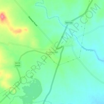
Name: Dahiwadi topographic map, elevation, terrain.
Location: Dahiwadi, Man, Satara, Maharashtra, 415508, India (17.68237 74.52189 17.72237 74.56189)
Average elevation: 724 m
Minimum elevation: 699 m
Maximum elevation: 783 m
Thank you for supporting this site ❤️
Make a donation
Make a donation
Gear up for your next adventure:
As an Amazon Associate, this site earns from qualifying purchases at no extra cost to you.