
Copperalley ED topographic map
Interactive map
Click on the map to display elevation.
About this map
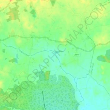
Name: Copperalley ED topographic map, elevation, terrain.
Average elevation: 78 m
Minimum elevation: 66 m
Maximum elevation: 96 m
Other topographic maps
Click on a map to view its topography, its elevation and its terrain.
Middleton ED
Middleton ED, The Municipal District of Athlone — Moate, County Westmeath, Condado de Westmeath, Leinster, N91 W97W, Irlanda
Average elevation: 89 m
Mullingar
Irlanda > County Westmeath > Mullingar
Mullingar, The Municipal District of Mullingar — Kinnegad, County Westmeath, Leinster, N91 FY58, Irlanda
Average elevation: 101 m