
East Boothbay topographic map
Interactive map
Click on the map to display elevation.
About this map
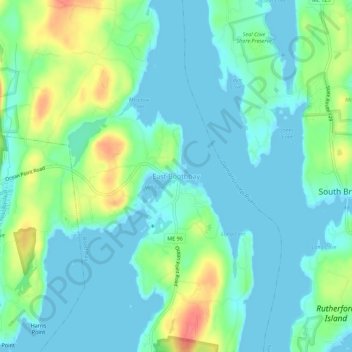
Name: East Boothbay topographic map, elevation, terrain.
Average elevation: 16 m
Minimum elevation: -4 m
Maximum elevation: 59 m
Other topographic maps
Click on a map to view its topography, its elevation and its terrain.
Cabbage Island
United States > Maine > Lincoln County > Boothbay
Cabbage Island, Boothbay, Lincoln County, Maine, 04538, United States
Average elevation: 17 m
Barters Island
United States > Maine > Lincoln County > Boothbay
Barters Island, Boothbay, Lincoln County, Maine, 04571, United States
Average elevation: 18 m