
Thank you for supporting this site ❤️
Make a donation
Make a donation
Gear up for your next adventure:
As an Amazon Associate, this site earns from qualifying purchases at no extra cost to you.
Vattiz topographic map
Click on the map to display elevation.
Thank you for supporting this site ❤️
Make a donation
Make a donation
Gear up for your next adventure:
As an Amazon Associate, this site earns from qualifying purchases at no extra cost to you.
About this map
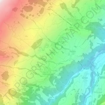
Name: Vattiz topographic map, elevation, terrain.
Location: Vattiz, Lumnezia, Surselva, Grisons, 7146, Switzerland (46.68685 9.13911 46.72685 9.17911)
Average elevation: 1,324 m
Minimum elevation: 850 m
Maximum elevation: 2,099 m
Thank you for supporting this site ❤️
Make a donation
Make a donation
Gear up for your next adventure:
As an Amazon Associate, this site earns from qualifying purchases at no extra cost to you.